
Mind map
HIDROGRAFÍA DE CASTILLA Y LEÓN
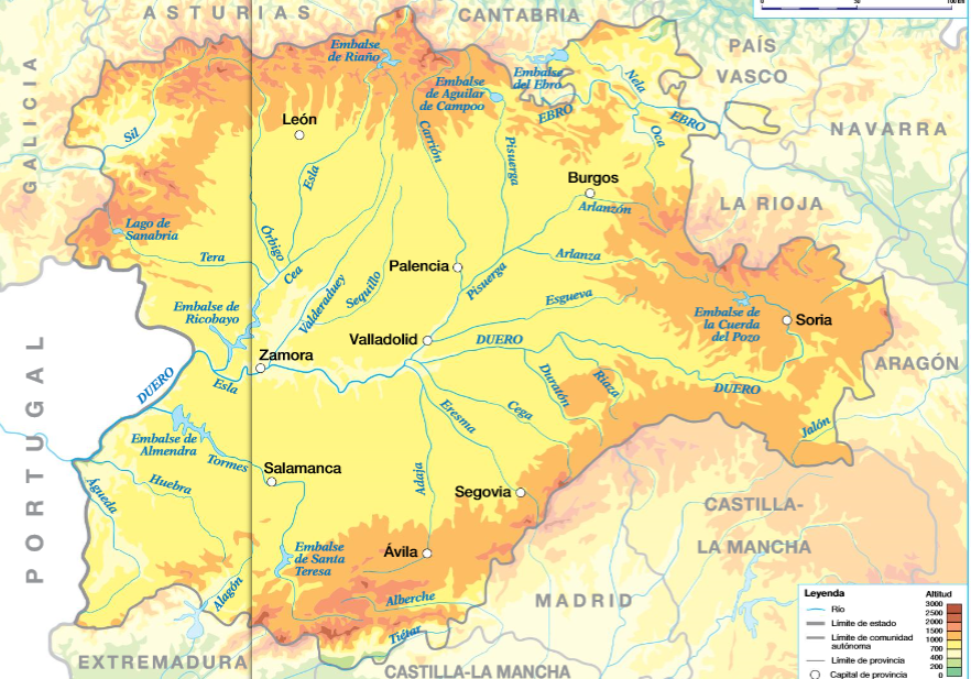
Map content
HIDROGRAFÍA DE CASTILLA Y LEÓN
RÍO DUERO
- nace en Picos de Urbión
- pasa por provincias de Soria, Burgos, Valladolid, Zamora y Salamanca
- desemboca en O. Atlántico en Oporto
- afluentes
- Cordillera Cantábrica
- Pisuerga
- Esla
- Sistema Central
- Eresma
- Tormes
- Cordillera Cantábrica
OTROS RÍOS
- Sil
- Ebro
EMBALSES
- Almendra en Tormes
- Ricobayo en Esla
- Ebro en Ebro
LAGOS Y LAGUNAS
- Villafáfila
- La Nava
- Laguna Negra
- Sanabria
Images and files in the map
Information
- Description
- Hidrografía de Castilla y León
- Created by
- Roberto Vicente Rodriguez Blanco · Nov 2016
- Updated
- Nov 5, 2018
- Views
- 2,616
- Tags
- Rating