
Flashcards
LC Short questions; Pictures & Map work
Cards in this deck (27)
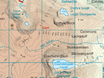
- 1—Tarn
Glacial erosion
Contour lines packed tight on 3 sides.
Colour darker on 3 sides.
4th side contours are spaced.
Colour is lighter. - 2—Glacial erosion
Plucking & Abrasion
Start of Glacier
Depression with 3 steep sides & 1 open
With a lake = tarn
Without lake = Corrie/cirque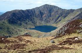
- 3—Ox Bow Lakes
Horse shoe shape lake.
Cut off meander.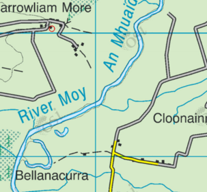
- 4—Levee
Raised banks of earth beside the river channel.
Spot heights and contour lines show them.
Old stage of river.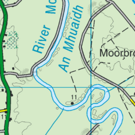
- 5—V shape valley & waterfall
Found in mountains.
Brown color
Tightly packed contour lines
Contour lines make "V shape"
Waterfalls may be labelled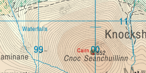
- 6—Arete
Glacial erosion
Thin piece of high ground that separates one corrie/tarn from another.
Contours packed tightly.
Brown color.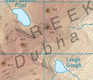
- 7—Ribbon lakes AKA Paternoster lakes
Glacial erosion
Plucking & Abrasion
Found in U shape valley floor (Green).
Steep sides (Tight contours & Brown colour)
Lakes connected by a River
Trellised Drainage pattern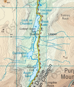
- 8—Drumlins
Glacial Deposition
Small hills dotting the land.
Submerged in Clew Bay
Spot height will show change in height.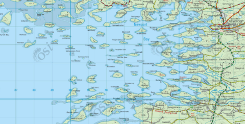
- 9—Flood plain
River deposition
Old stage of Rivers
Green color nearest river channel.
Widely spaced contour lines.
Spot heights show height.
Flat land.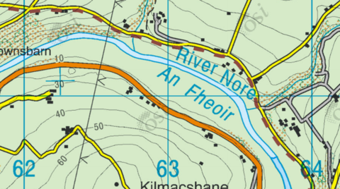
- 10—Sea cliff
Coastal deposition
Light/brown color.
Tightly packed contour lines.
Spot heights.
Near sea/ocean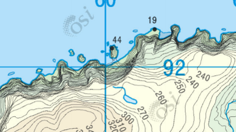
- 11—Lagoon & Sand Bar
Bar: Strip of land that covers off a bay.
Lagoon: Water trapped behind the sand bar.
Land here is salt marsh as the water dries up.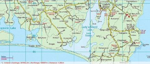
- 12—A= Sea stack
B=Sea Arch
C= Blow hole
D = Beach/Bay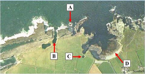
- 13—A= Terracettes
B= Landslide
C= Mudflow
D= Rotational slump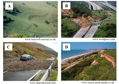
- 14—A= Concave slope
B= Even slope
C= Dendritic
D= Drumlins
E= Cut off meander
F= Trellised drainage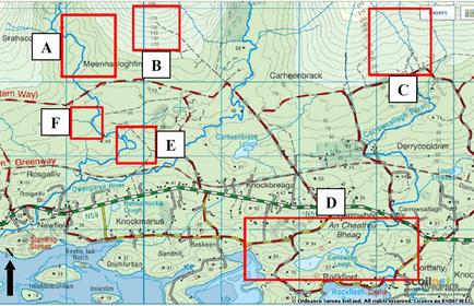
- 15—A= Sandstorm
B= Open cast mining
C= Forest Fire
D= Delta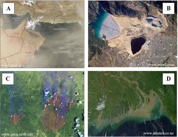
- 16—1= B
2= C
3= D
4= A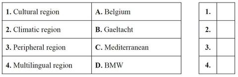
- 17—A= Volcanic ash
B= Forest Fire
C= Deforestation
D= Glacier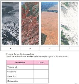
- 18Groyne Offshore bar Cliff Rock armourA= Offshore bar
B= Groyne
C= Cliff
D= Rock armour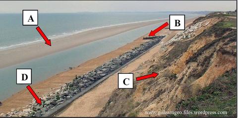
- 19—A= Meander
B= Arete
C = V shape valley
D= U shape valley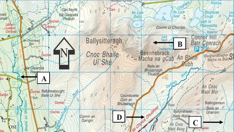
- 20—A= North American
B= Eurasian
C= Africian
D= South American
E= Constructive/Divergent
F= Transform
G= Destructive/Convergent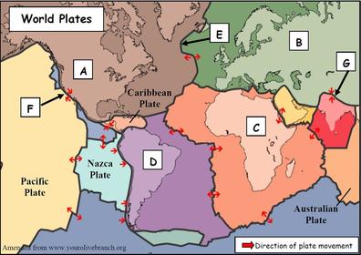
- 21—A= Radial
B= Trellised
C= Denderitic
D= Deranged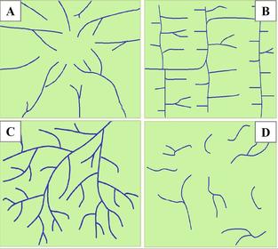
- 22—A= Tremors
B= Fault line
C= Focus
D= Epicenter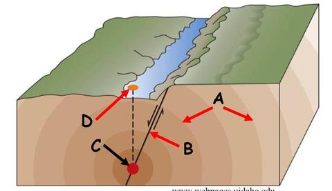
- 23—A= Tarn
B= Truncated spur
C= Arete
D= Hanging Valley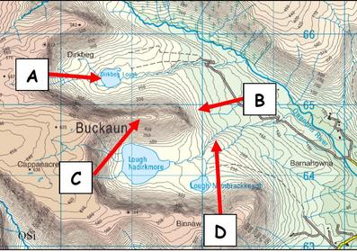
- 24—A= Attrition
B= Terracetes
C= Blowhole
D= Scree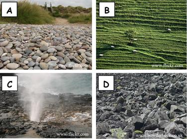
- 25—A= Later moraine
B= Arete
C= Pyramidal peak
D= Corrie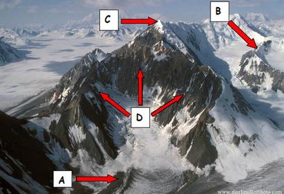
- 26—A= Lava
B= Ash cloud/gas
C= Crater
D= Pyroclastic material
E= Magma Reserve
F= Secondary vent
G= Vent
H= Parasitic cone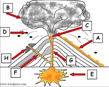
- 27—Central plain = C
Wallonia = D
Mediterranean = A
Berlin = B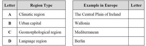
Information
- Description
- LC Short questions; Pictures & Map work
- Created by
- Steven Morgan
- Views
- 377
- Tags
- Rating