
Flashcards
Geography Study Flashcards
Cards in this deck (35)
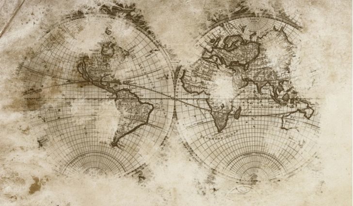
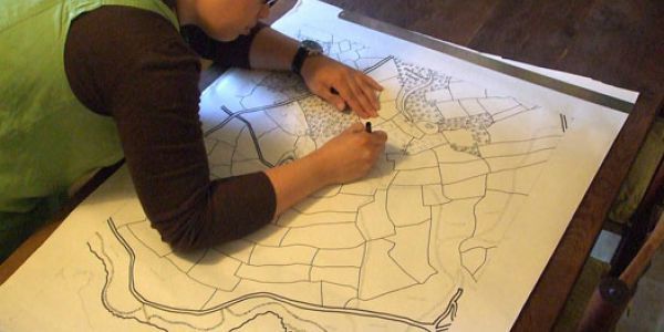
- 1What is Cartography?The Study of Map-Making
- 2What is a Cartographer?Someone Who Uses Information to Create Maps
- 3What is a Physical Map?A Physical Map Shows the Earth's Natural Features, Such as,
-Mountains
-Rivers
-Oceans
-Forests
-Wetland
-Etc.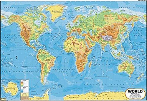
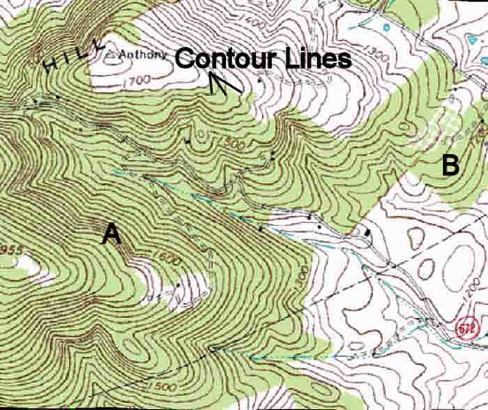
- 4What are Topographical or Contour Maps?They Show the Elevation of the Landscape. Lines are Used at Intervals to Show Hills and Valleys. (Ex. 100m, 200m, 300m, etc)
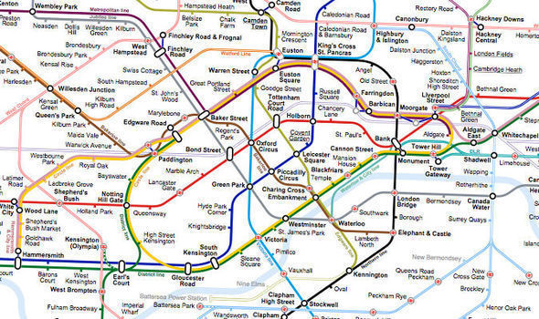
- 5What is a Transportation Map?Transportation Maps Use Lines to Display Preferred Routes or Roadways.
- 6What is a Political Map?They Show Political Boundary Lines Between Areas. These Separate Areas Controlled by Different Governments.
(Federal, Provincial/State, Country, Municipal)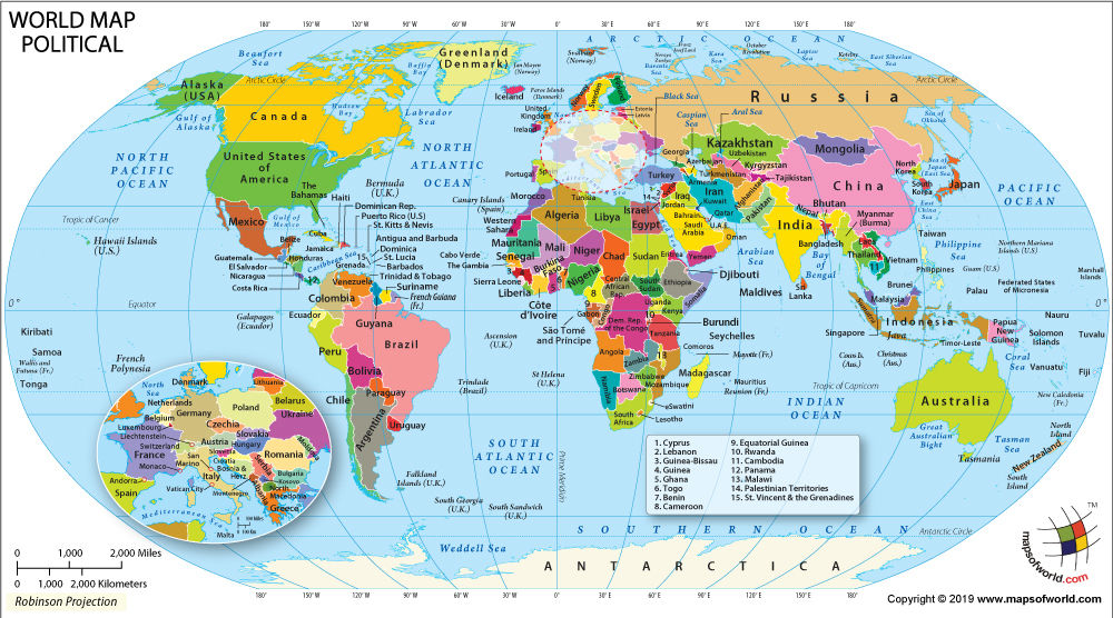
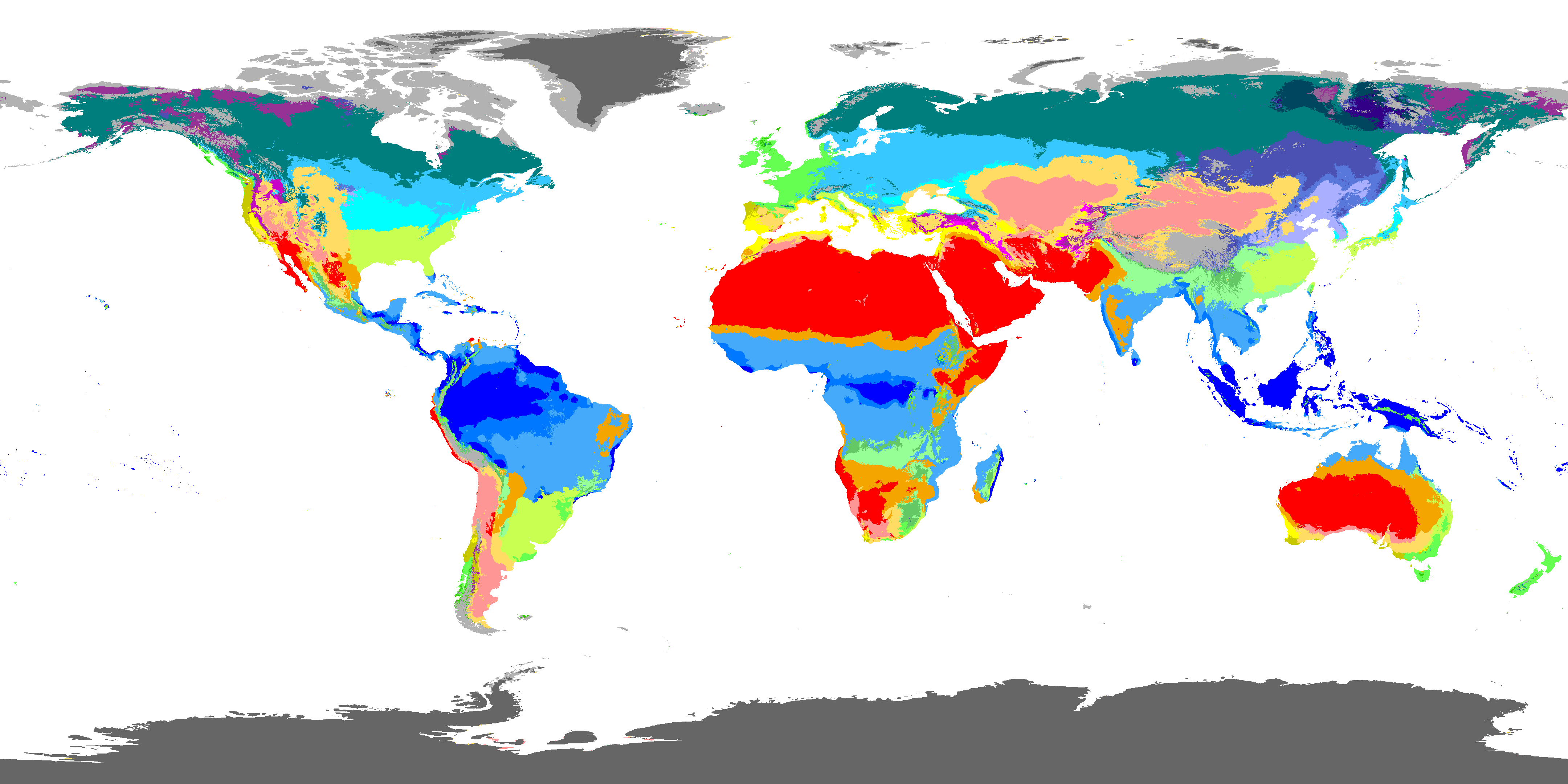
- 7What is a Climate Map?It Shows Areas That Experience Different Climates.
- 8What is a Population Map?Shows Areas That Have High or Low Population Density.
(The Number of People at a Location)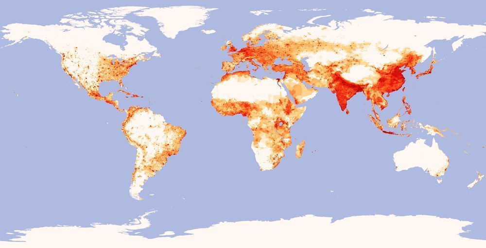
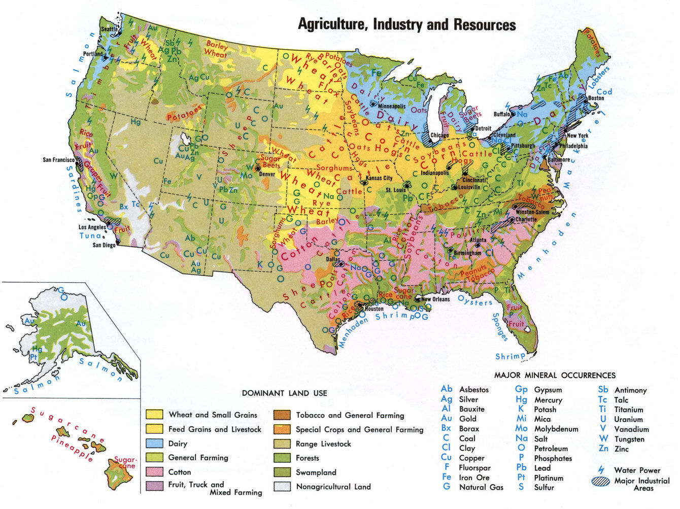
- 9What is an Industrial Resources Map?Shows Locations of Known Industry and Usable Resources.
- 10What is a Land Use Map?Shows how the Landscape is Being Used by Humans.
(Parks, Agriculture, Residential, etc)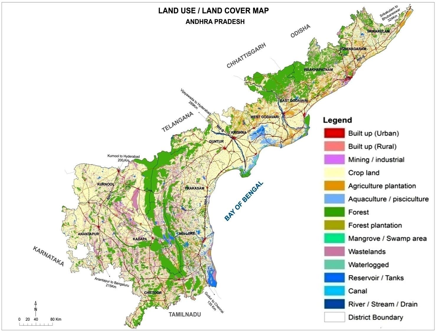
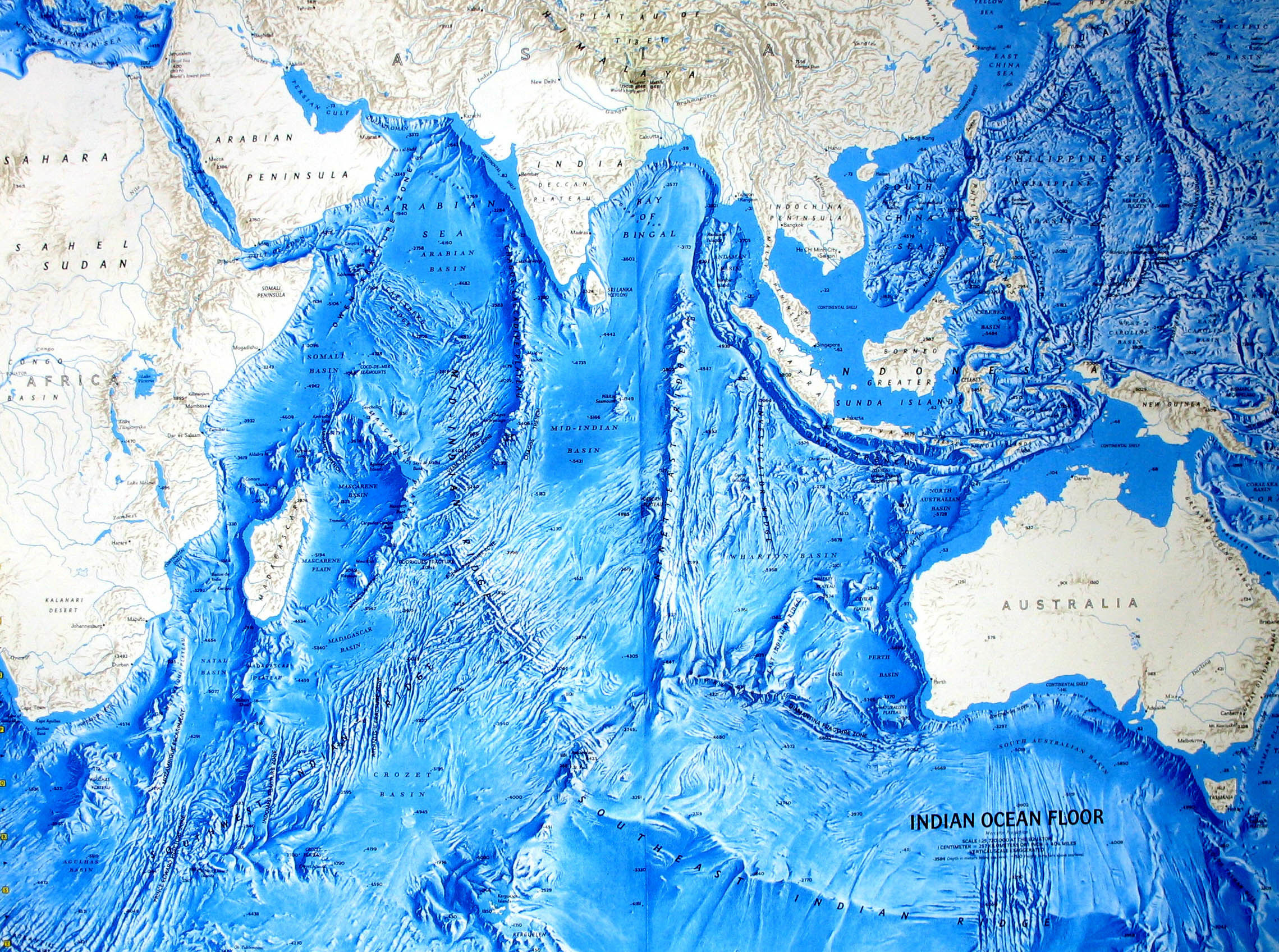
- 11What is an Undersea Map?Shows the Underwater Landscape; Giving us a Measurement of Depth.
- 12What is a THEMATIC Map?Any Map, That Displays Information as the Distribution of Information, is Known as a THEMATIC MAP Therefore, Maps that Display Population Density, Climate, Land Use, etc, are all Considered Thematic Maps.
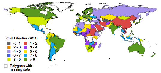
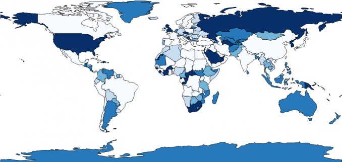
- 13What is a Choropleth Map?They're Maps That Use Colouring and Shading to Represent Information on a Map. The Lightness or Darkness of the Colour Indicates the Intensity of the Information.
- 14What is Latitude and Longitude ?Latitude: Lines That Run East to West Down the Equator.
Longitude: Lines Running From Pole to Pole.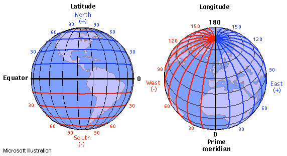
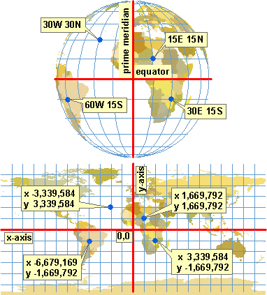
- 15How do You Determine Coordinates on a Map?The Destination You Need to Find on a Map.
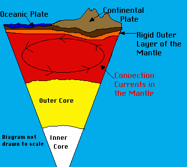
- 16What are the Layers Inside the Earth?1. Crust (10-70km)
Made of Soil, Rock, Water, Minerals, Plants, Animals.
2. Mantle (2,900km Thick)
Made of Flowing Semi-Melted Rock.
3. Core (2,400km)
A Sphere Made of Hard Metals in the Middle.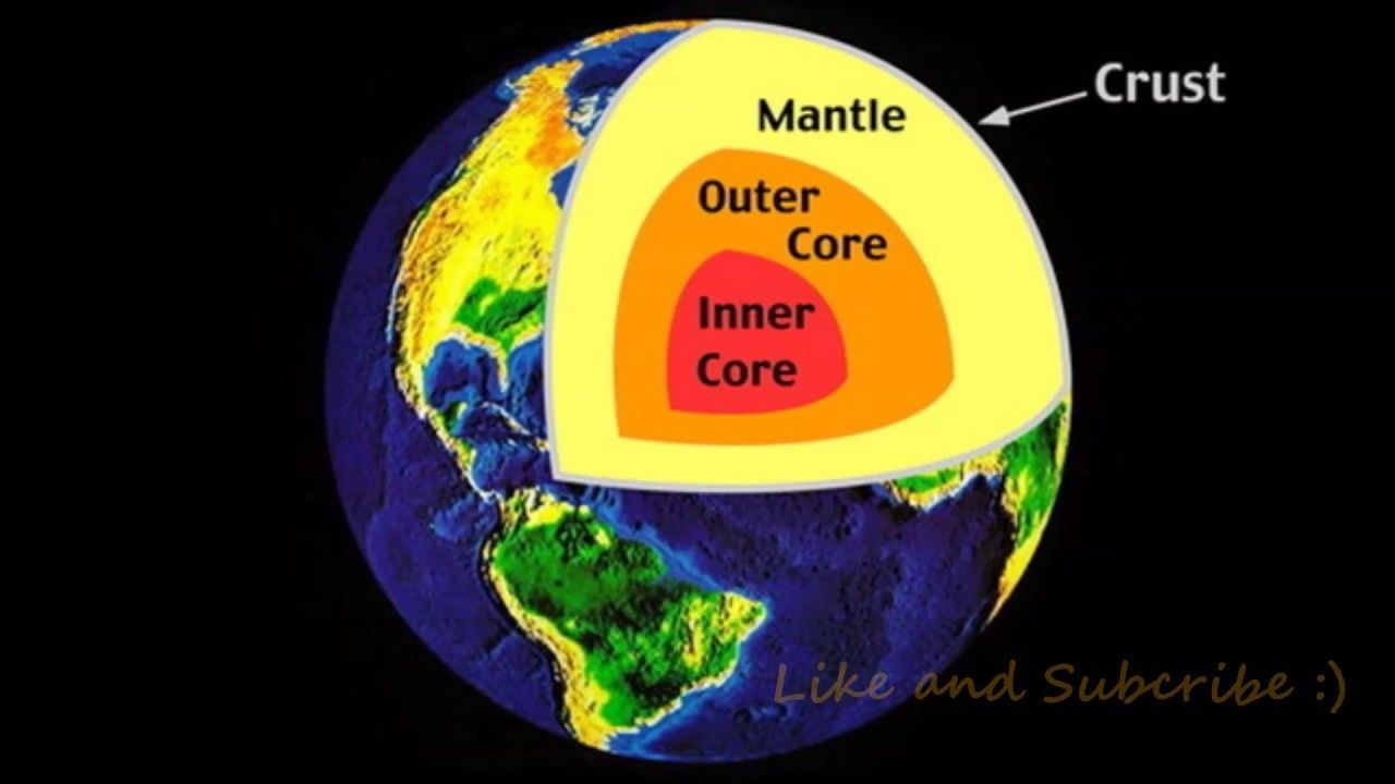
- 17What are Convection Currents?They are Currents That Move Rapidly or Gasses, and Liquids That the Molecules Inside Have to Move Around Freely.
- 18Who Created the Continental Drift Theory and What is it?Alfred Wegner a Scientist who Believed the Continents Fit Earlier in the World's History, Forming one Land Mass he Called PENGEA. ("All Lands")
The Continental Drift Theory That the Continents are Slowly Moving Away From Each Other.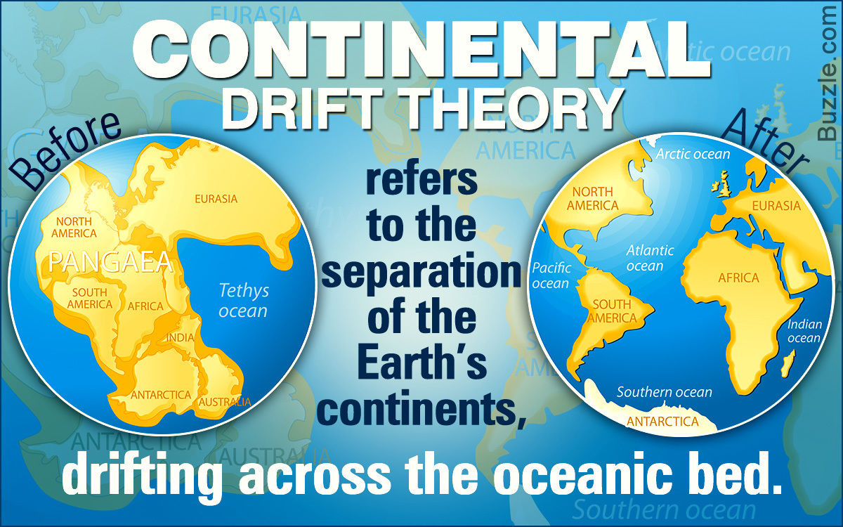
- 19What are the Plate Tectonics?It's the Field of Study That Investigates how Moving Plates Affect our World on the Surface.
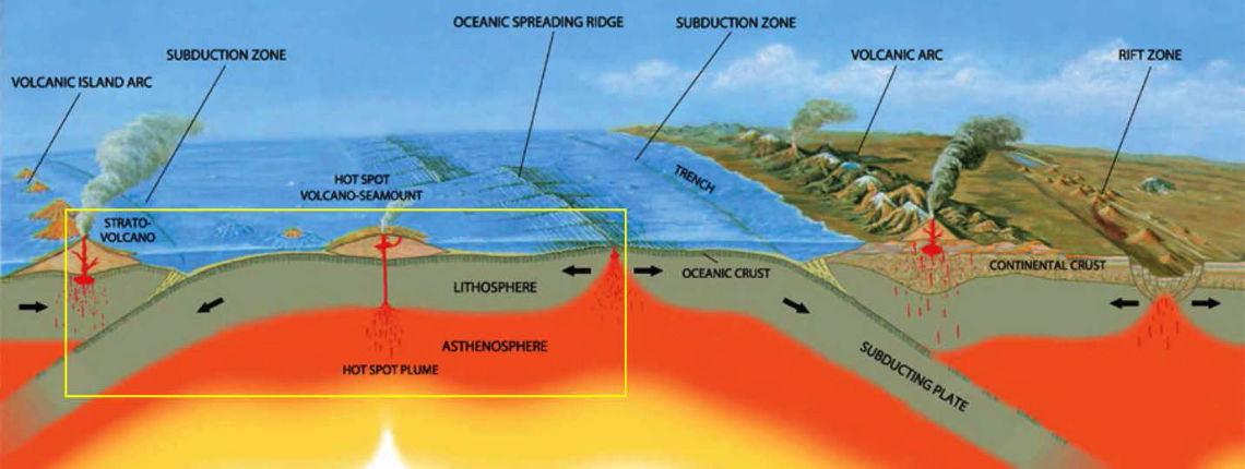
- 20Three Plate Boundaries and Their Differences.1. Transform
2. Convergent
3. Divergent - 211. TransformThese Plates Rub Past Each Other. What Tension is Released in a Big Event, we Feel an Earthquake.
- 222. ConvergentOne Plate Pushes Into Another. The Heavier Plate is Forced Down Under the Lighter one. This is a Subduction Zone. Like a Bulldozer, the Heavier Plate Also Pushes and Crumples the Lighter one Forming Fold Mountain Chains. As the Rock Folds and Cracks, hot Liquid Creeps up the Crack and out, Forming Volcanoes.
- 233. DivergentAs Plates Move Away From Each Other, a Large Valley is Created. (Rift Valley) This Fills up with Water to Form an Ocean. Hot Liquid Rock Bubbles up Through to Form a Mid-Ocean Ridge.
- 24Landform Map of CanadaIt's Made up of the Canadian Shield, Interior Plains, Western Cordillera, Arctic, Innuitatian, the Appalachians, and the Great Lakes-St Lawrence Lowlands.
- 25History of the Canadian ShieldThe Region was Once Part of a Different, Ancient Continent Named "ARCTICA". This Continent was full of Ancient Volcanoes Known as Shield Volcanoes.
- 26How the Other Landforms in Canada EmergedThe Were Created from Volcanic Rock Forming a Solid Island Then Trees and Vegetation Came and Wallah, Canada Landforms.
- 27Alpine and Continental GlaciersContinental: Covers Large Areas of a Continent, Sometimes up to 2 or 3 Kilometers Thick.
Alpine: Exists in Mountain Regions at Higher Elevations. - 28How Glaciers Grow and Shrink Over TimeThe Glaciers Shrink as the Warm Air Becomes Hotter Melting the Ice, Creating Water That Sinks Down Slowly Picking Away at the Rock Underneath. The Cold Air Makes it Grow, Creating More Water When the Warm Air Hits Again.
- 29Ways the Glaciers Impacted the LandscapeThe Glaciers Scrape at the Earths Surface Creating a Flat Chunk of Land People Camp on.
- 30How the Great Lakes Were FormedThe Great Lakes Where Formed by the Thick Giant Ice Mountains Scraping and the Ground While Creating large Gaps in the Ground and Melting Filling them with Water.
- 31Climate Map of CanadaMade up of the Arctic, Subarctic, Pacific, Mountains, Prairies, Lower Lakes, and the Atlantic.
- 32Prevailing Winds in CanadaDominant Wind Directions at Certain Latitudes. Most of Canada is Impacted by Westerlies.
- 33Windward and Leeward Sides of MountainsThe Windward Side of the Mountains has Heavy Rains While the Leeward Side has Next to None.
- 34Dominant air Masses in North AmericaAmerica has Hot Moist Air Around the Edge where the Lakes and Oceans are, While There is Hot and Dry Air in the Middle.
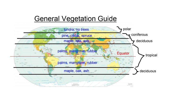
- 35Vegetation Map of CanadaYou Would Find Grasslands Anywhere but in the Poles (Unless the Snow Melted), The Tundra is in the Poles, Coniferous Forests are Pine, Cedar, and Spruce. Deciduous Forests are Maple, Oak, and Ash.
Information
- Description
- Grade 9 Geography Flashcards on Geography Study Flashcards , created by Aimee Bower FEM on 22/10/2019.
- Created by
- Aimee Bower FEM
- Views
- 5
- Rating