
Mind map
Tsunami and Plate margins!
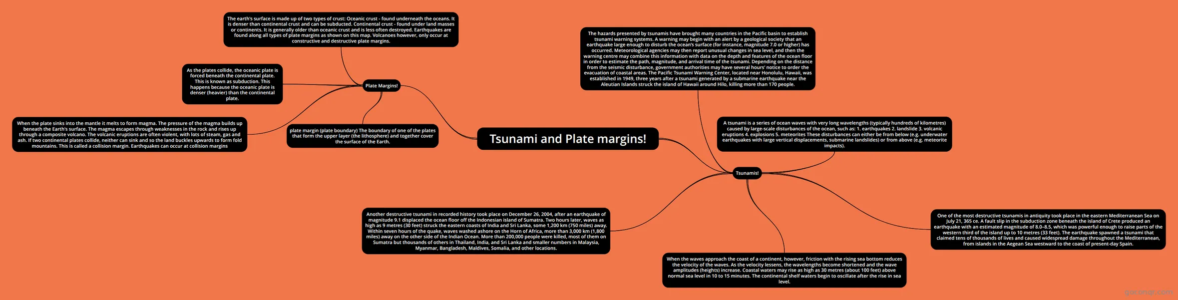
Mind map: Tsunami and plate margins
Map content
Tsunami and Plate margins!
Tsunamis!
- A tsunami is a series of ocean waves with very long wavelengths (typically hundreds of kilometres) caused by large-scale disturbances of the ocean, such as: 1. earthquakes 2. landslide 3. volcanic eruptions 4. explosions 5. meteorites These disturbances can either be from below (e.g. underwater earthquakes with large vertical displacements, submarine landslides) or from above (e.g. meteorite impacts).
- When the waves approach the coast of a continent, however, friction with the rising sea bottom reduces the velocity of the waves. As the velocity lessens, the wavelengths become shortened and the wave amplitudes (heights) increase. Coastal waters may rise as high as 30 metres (about 100 feet) above normal sea level in 10 to 15 minutes. The continental shelf waters begin to oscillate after the rise in sea level.
- One of the most destructive tsunamis in antiquity took place in the eastern Mediterranean Sea on July 21, 365 ce. A fault slip in the subduction zone beneath the island of Crete produced an earthquake with an estimated magnitude of 8.0–8.5, which was powerful enough to raise parts of the western third of the island up to 10 metres (33 feet). The earthquake spawned a tsunami that claimed tens of thousands of lives and caused widespread damage throughout the Mediterranean, from islands in the Aegean Sea westward to the coast of present-day Spain.
- Another destructive tsunami in recorded history took place on December 26, 2004, after an earthquake of magnitude 9.1 displaced the ocean floor off the Indonesian island of Sumatra. Two hours later, waves as high as 9 metres (30 feet) struck the eastern coasts of India and Sri Lanka, some 1,200 km (750 miles) away. Within seven hours of the quake, waves washed ashore on the Horn of Africa, more than 3,000 km (1,800 miles) away on the other side of the Indian Ocean. More than 200,000 people were killed, most of them on Sumatra but thousands of others in Thailand, India, and Sri Lanka and smaller numbers in Malaysia, Myanmar, Bangladesh, Maldives, Somalia, and other locations.
- The hazards presented by tsunamis have brought many countries in the Pacific basin to establish tsunami warning systems. A warning may begin with an alert by a geological society that an earthquake large enough to disturb the ocean’s surface (for instance, magnitude 7.0 or higher) has occurred. Meteorological agencies may then report unusual changes in sea level, and then the warning centre may combine this information with data on the depth and features of the ocean floor in order to estimate the path, magnitude, and arrival time of the tsunami. Depending on the distance from the seismic disturbance, government authorities may have several hours’ notice to order the evacuation of coastal areas. The Pacific Tsunami Warning Center, located near Honolulu, Hawaii, was established in 1949, three years after a tsunami generated by a submarine earthquake near the Aleutian Islands struck the island of Hawaii around Hilo, killing more than 170 people.
Plate Margins!
- plate margin (plate boundary) The boundary of one of the plates that form the upper layer (the lithosphere) and together cover the surface of the Earth.
- The earth's surface is made up of two types of crust: Oceanic crust - found underneath the oceans. It is denser than continental crust and can be subducted. Continental crust - found under land masses or continents. It is generally older than oceanic crust and is less often destroyed. Earthquakes are found along all types of plate margins as shown on this map. Volcanoes however, only occur at constructive and destructive plate margins.
- As the plates collide, the oceanic plate is forced beneath the continental plate. This is known as subduction. This happens because the oceanic plate is denser (heavier) than the continental plate.
- When the plate sinks into the mantle it melts to form magma. The pressure of the magma builds up beneath the Earth's surface. The magma escapes through weaknesses in the rock and rises up through a composite volcano. The volcanic eruptions are often violent, with lots of steam, gas and ash. If two continental plates collide, neither can sink and so the land buckles upwards to form fold mountains. This is called a collision margin. Earthquakes can occur at collision margins
Information
- Description
- A level Geography Mind Map on Tsunami and Plate margins!, created by Game Streaming on 24/01/2019.
- Created by
- Game Streaming
- Views
- 2
- Rating