7107896
Description

Mind Map by Logan Franco, updated more than 1 year ago
|
|
Created by Logan Franco
almost 8 years ago
|
|
Economic
Geology
- What does it
cover?
- Topics you have to know.
- Water, underground and overground storage.
- Aquifers
- All sedimentary will have a fairly high percentage of pore space. In those pores are found water supplies. 2 billion
people around the world, over 17 million in the UK rely on aquifers for their water supply.
- Areas with heavy amounts of sandstone are Shrewsbury and Bridgnorth with Permo-Triassic sandstone.
- London has masses of Chalk and undifferentiated post-carboniferious rocks.
- Areas with heavy amounts of sandstone are Shrewsbury and Bridgnorth with Permo-Triassic sandstone.
- All sedimentary will have a fairly high percentage of pore space. In those pores are found water supplies. 2 billion
people around the world, over 17 million in the UK rely on aquifers for their water supply.
- Aquifers
- Finding Economic Resources - Four methods.
- Seismic Survey
- A ship, towing a source of seismic waves (airgun), travels along a transect (a line). At set times, a shock wave is
generated in the form of seismic waves. These waves travel to the ocean floor, travel through the rocks and get
reflected wherever there is a change is density - ie a change in rock type. The reflected waves travel back to the
ocean floor and up to the receivers on the cable being towed behind. The receivers then generate an image of the
rocks structure below, which a geophysicist will analyse and decide whether to recommend a test borehole
(£100,000 to 1,000,0000)
- This does not confirm the rocks down there
- This does not confirm the rocks down there
- A ship, towing a source of seismic waves (airgun), travels along a transect (a line). At set times, a shock wave is
generated in the form of seismic waves. These waves travel to the ocean floor, travel through the rocks and get
reflected wherever there is a change is density - ie a change in rock type. The reflected waves travel back to the
ocean floor and up to the receivers on the cable being towed behind. The receivers then generate an image of the
rocks structure below, which a geophysicist will analyse and decide whether to recommend a test borehole
(£100,000 to 1,000,0000)
- Borehole
- This is a long tube which digs down into the earth surface, it is expensive to set up. This
confirms the rocks which are below as well as if there are oil.
- This is a long tube which digs down into the earth surface, it is expensive to set up. This
confirms the rocks which are below as well as if there are oil.
- Geochemical Analysis
- Geochemical analysis can predict where petroleum, metals, water, and commercially valuable minerals can be
located—a branch of the science known as geochemical prospecting.
- Geochemical analysis can predict where petroleum, metals, water, and commercially valuable minerals can be
located—a branch of the science known as geochemical prospecting.
- Magnetic Survey
- Magnetic surveys record spatial variation in the Earth's magnetic field. In archaeology, magnetic surveys are used
to detect and map archaeological artefacts and features.
- An aeromagnetic survey is a common type of geophysical survey carried out using a magnetometer aboard or
towed behind an aircraft.
- An aeromagnetic survey is a common type of geophysical survey carried out using a magnetometer aboard or
towed behind an aircraft.
- Magnetic surveys record spatial variation in the Earth's magnetic field. In archaeology, magnetic surveys are used
to detect and map archaeological artefacts and features.
- Seismic Survey
- Waste disposal and the associated issues of pollution.
- Building engineering projects - tunnels, cuttings and dams
- Dams
- An Engineering Structure constructed across a valley or natural depression to create a water storage reservoir. Such
reservoirs are required for three main purposes: provision of a dependable water supply for domestic and/or irrigation
use; flood mitigation: and generation of electric power. In providing a water supply, the reservoir storage is filled during
the periods of above-average streamflow, thus ensuring a steady supply of water during periods of little or no streamflow.
For flood mitigation, the storage reservoir is kept nearly empty during drought and periods of low rainfall, so that when
the flood-generating rainstorms occur, the storage volume available in the reservoir provides a buffer against severe
flooding in the river valley downstream of the dam. For power generation, the storage reservoir provides a head of water
upstream of the dam, and the potential energy of this water is converted first to kinetic energy
- Tunnels
- Structural Geology aims to characterise deformation structures (geometry), to characterize flow paths followed by
particles during deformation (kinematics), and to infer the direction and magnitude of the forces involved in
driving deformation (dynamics). A field-based discipline, structural geology operates at scales ranging from 100
microns to 100 meters (i.e. grain to outcrop). In the tunnel construction, a ground investigation such as surface
geological survey, boring investigation, seismic prospecting refraction method, electrical exploration, etc. are
carried out prior to construction, and the results are summarized in the geological profile. However, most of these
investigations were conducted from surface, and several assumptions were made in the interpretation of the
ground profile. Discover the world's research
- Cuttings
- Dams
- Research Geologists - what do they actually do.
- 1) Communicate geological findings by writing research papers, participating in conferences, and/or teaching geological science at
universities. 2) Measure characteristics of the Earth, such as gravity and magnetic fields, using equipment such as seismographs,
gravimeters, torsion balances, and magnetometers. 3) Test industrial diamonds and abrasives, soil, or rocks in order to determine
their geological characteristics, using optical, x-ray, heat, acid, and precision instruments. 4) Identify deposits of construction
materials, and assess the materials' characteristics and suitability for use as concrete aggregates, road fill, or in other applications.
5) Develop applied software for the analysis and interpretation of geological data. 6) Analyze and interpret geological, geochemical,
and geophysical information from sources such as survey data, well logs, boreholes, and aerial photos. 7) Plan and conduct
geological, geochemical, and geophysical field studies and surveys;
- Oil & Gas - formation, trapping and extraction, and issues caused.
- Oil & Gases (Under Water)
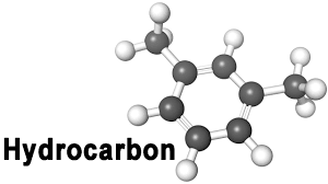
- Hydrocarbons (CH)
- Formed as microscopic marine animals die, sink, get buried & breakdown whilst under pressure / heat. The rock in
which the animals are buried is known as the source rock. (Black Shale)
- Oil / gas migrates up to a rock which has pore spaces - must have high porosity - e.g. Sandstone - this is known
as the reservoir rock - the gas sits ontop of oil (ontop of H2O)
- On top of the reservoir rock must be an impermeable layer that “traps” the oil in. e.g. Shale - this is known as the
cap rock.
- On top of the reservoir rock must be an impermeable layer that “traps” the oil in. e.g. Shale - this is known as the
cap rock.
- Oil / gas migrates up to a rock which has pore spaces - must have high porosity - e.g. Sandstone - this is known
as the reservoir rock - the gas sits ontop of oil (ontop of H2O)
- Formed as microscopic marine animals die, sink, get buried & breakdown whilst under pressure / heat. The rock in
which the animals are buried is known as the source rock. (Black Shale)
- Hydrocarbons (CH)
- Oil & Gases (Under Water)
- Economic Uses of Minerals and Rocks
- Water, underground and overground storage.
- Topics you have to know.
Media attachments
Want to create your own Mind Maps for free with GoConqr? Learn more.