
Mind map
Tectonic Landscape
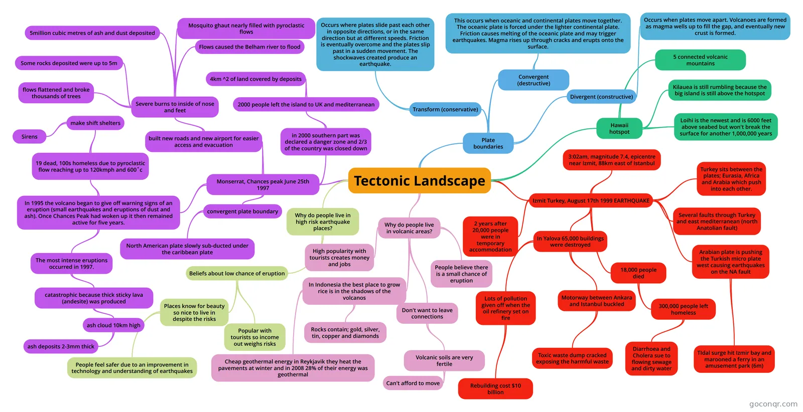
Mind map: Tectonic Landscape and Plate Boundaries
Map content
Tectonic Landscape
Hawaii hotspot
- 5 connected volcanic mountains
- Kilauea is still rumbling because the big island is still above the hotspot
- Loihi is the newest and is 6000 feet above seabed but won't break the surface for another 1,000,000 years
Izmit Turkey, August 17th 1999 EARTHQUAKE
- 3:02am, magnitude 7.4, epicentre near Izmit, 88km east of Istanbul
- Turkey sits between the plates; Eurasia, Africa and Arabia which push into each other.
- Several faults through Turkey and east mediterranean (north Anatolian fault)
- Arabian plate is pushing the Turkish micro plate west causing earthquakes on the NA fault
- TIdal surge hit Izmir bay and marooned a ferry in an amusement park (6m)
- 18,000 people died
- 300,000 people left homeless
- Diarrhoea and Cholera sue to flowing sewage and dirty water
- 300,000 people left homeless
- In Yalova 65,000 buildings were destroyed
- Motorway between Ankara and Istanbul buckled
- Toxic waste dump cracked exposing the harmful waste
- Lots of pollution given off when the oil refinery set on fire
- Rebuilding cost $10 billion
- Motorway between Ankara and Istanbul buckled
- 2 years after 20,000 people were in temporary accommodation
Why do people live in volcanic areas?
- People believe there is a small chance of eruption
- Don't want to leave connections
- Volcanic soils are very fertile
- Can't afford to move
- Volcanic soils are very fertile
- In Indonesia the best place to grow rice is in the shadows of the volcanos
- Rocks contain; gold, silver, tin, copper and diamonds
- Cheap geothermal energy in Reykjavik they heat the pavements at winter and in 2008 28% of their energy was geothermal
- High popularity with tourists creates money and jobs
Why do people live in high risk earthquake places?
- Beliefs about low chance of eruption
- Places know for beauty so nice to live in despite the risks
- People feel safer due to an improvement in technology and understanding of earthquakes
- Popular with tourists so income out weighs risks
- Places know for beauty so nice to live in despite the risks
- Beliefs about low chance of eruption
Plate boundaries
- Convergent (destructive)
- This occurs when oceanic and continental plates move together. The oceanic plate is forced under the lighter continental plate. Friction causes melting of the oceanic plate and may trigger earthquakes. Magma rises up through cracks and erupts onto the surface.
- Divergent (constructive)
- Occurs when plates move apart. Volcanoes are formed as magma wells up to fill the gap, and eventually new crust is formed.
- Transform (conservative)
- Occurs where plates slide past each other in opposite directions, or in the same direction but at different speeds. Friction is eventually overcome and the plates slip past in a sudden movement. The shockwaves created produce an earthquake.
- Convergent (destructive)
Monserrat, Chances peak June 25th 1997
- In 1995 the volcano began to give off warning signs of an eruption (small earthquakes and eruptions of dust and ash). Once Chances Peak had woken up it then remained active for five years.
- The most intense eruptions occurred in 1997.
- catastrophic because thick sticky lava (andesite) was produced
- ash cloud 10km high
- ash deposits 2-3mm thick
- ash cloud 10km high
- catastrophic because thick sticky lava (andesite) was produced
- 19 dead, 100s homeless due to pyroclastic flow reaching up to 120kmph and 600˚c
- make shift shelters
- Sirens
- make shift shelters
- The most intense eruptions occurred in 1997.
- convergent plate boundary
- North American plate slowly sub-ducted under the caribbean plate
- in 2000 southern part was declared a danger zone and 2/3 of the country was closed down
- 2000 people left the island to UK and mediterranean
- 4km ^2 of land covered by deposits
- 2000 people left the island to UK and mediterranean
- built new roads and new airport for easier access and evacuation
- Severe burns to inside of nose and feet
- flows flattened and broke thousands of trees
- Some rocks deposited were up to 5m
- 5million cubic metres of ash and dust deposited
- Mosquito ghaut nearly filled with pyroclastic flows
- Flows caused the Belham river to flood
- Severe burns to inside of nose and feet
- In 1995 the volcano began to give off warning signs of an eruption (small earthquakes and eruptions of dust and ash). Once Chances Peak had woken up it then remained active for five years.
Information
- Description
- A-Level Geography (Tectonic Landscapes) Mind Map on Tectonic Landscape, created by Katy Thompson on 29/05/2015.
- Created by
- Katy Thompson
- Views
- 34
- Tags
- Rating