Mind map
types of hazards and how we can measure them
Map content
types of hazards and how we can measure them
aspects of a hazard
- geophysical hazard - caused by land processes
- atmospheric - caused by atmospheric processes
- hydrological - caused by water bodies
- the frequency of a hazard
- the magnitude
- the intensity
human responses to hazards
- perception
- economic and cultural factors can influence perceptions
- response
- fatalism- hazards are uncontrollable and any losses sould be accepted
- prediction- using reacherch and past events so warnings can be made or potentially prevented
- adaptation - live with hazard by changing lifestyle choices
- mitigation- lessen severity
- managment- coordinated strategies to lessen severity
- risk sharing- community preparedness
- perception
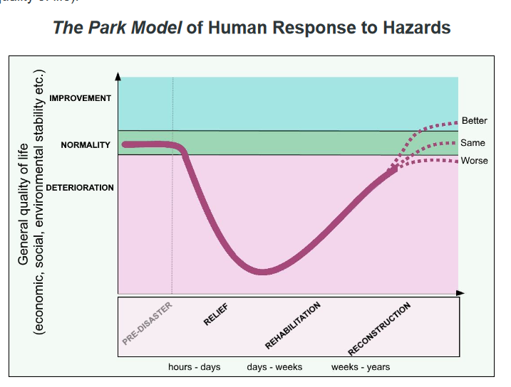
the park modle
- representation of steps carried out in hazard recovery
- rough indication of time frame
- the steepness of the curve shows how quickly an area deteriorates and recovers
- stage 1- relief
- immediate local response
- immediate appeal for foreign aid
- hours to days
- stage 2 - rehabilitation
- services begin to be restored
- temporary shelters and hospitals set up
- food and water distributed
- coordinated foreign aid, e.g military
- days to weeks
- stage 3 - reconstruction
- restoring area to same quality or better
- weeks to years
- area back to normal - crops, ecosystems
- infrastructure rebuilt and mitigation efforts for future
- representation of steps carried out in hazard recovery
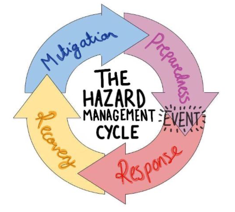
the hazard management cycle
- preparedness - being ready, education, training
- response - immediate action, evacuation, medical assistance
- recovery - long term responses, reconstruction
- mitigation- lessen affects of a future hazard, barriers, warning signals
- outlines the stages in responding to events
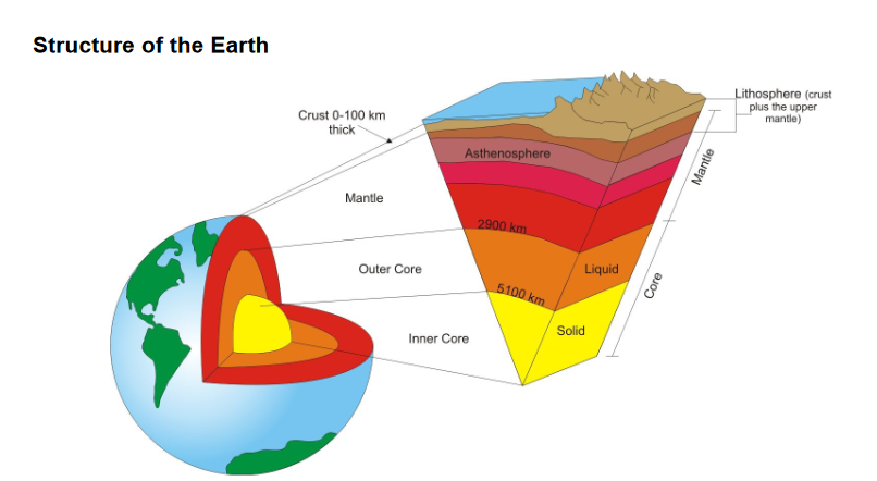
the structure of the earth
- inner core
- iron/nickle
- very hot due to pressure and radioactive decay
- outer core
- semi-molten
- iron/nickle
- mantle
- asthenosphere
- semi-molten
- moves due to convection currents
- lithosphere above
- broken up into plates
- made up of upper mantle and crust
- mainly solid, high in silicon
- asthenosphere
- crust
- oceanic crust is dense and is destroyed by plate movement
- continental crust is less dense and is not destroyed
- inner core