
Mind map
Plate Tectonics
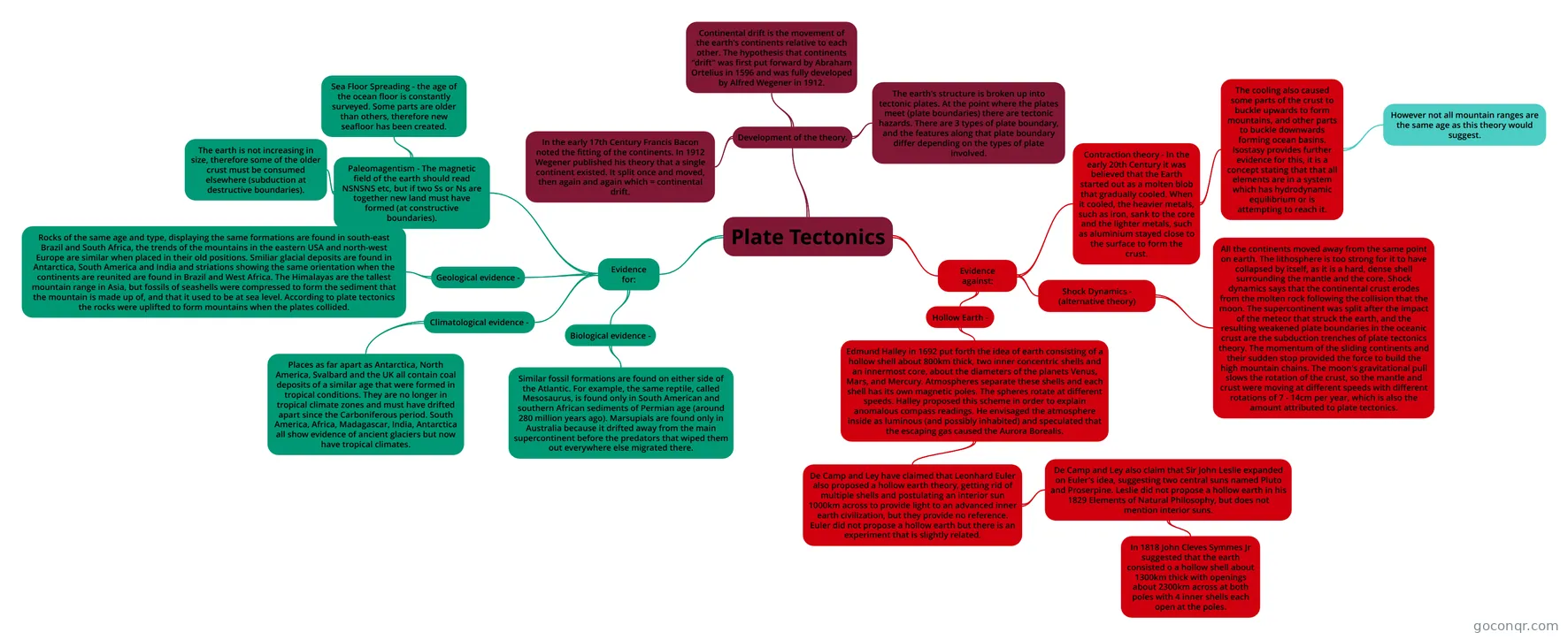
Mind map: Plate Tectonics
Map content
Plate Tectonics
Development of the theory.
- In the early 17th Century Francis Bacon noted the fitting of the continents. In 1912 Wegener published his theory that a single continent existed. It split once and moved, then again and again which = continental drift.
- Continental drift is the movement of the earth's continents relative to each other. The hypothesis that continents "drift" was first put forward by Abraham Ortelius in 1596 and was fully developed by Alfred Wegener in 1912.
- The earth's structure is broken up into tectonic plates. At the point where the plates meet (plate boundaries) there are tectonic hazards. There are 3 types of plate boundary, and the features along that plate boundary differ depending on the types of plate involved.
Evidence for:
- Paleomagentism - The magnetic field of the earth should read NSNSNS etc, but if two Ss or Ns are together new land must have formed (at constructive boundaries).
- Sea Floor Spreading - the age of the ocean floor is constantly surveyed. Some parts are older than others, therefore new seafloor has been created.
- The earth is not increasing in size, therefore some of the older crust must be consumed elsewhere (subduction at destructive boundaries).
- Geological evidence -
- Rocks of the same age and type, displaying the same formations are found in south-east Brazil and South Africa, the trends of the mountains in the eastern USA and north-west Europe are similar when placed in their old positions. Smiliar glacial deposits are found in Antarctica, South America and India and striations showing the same orientation when the continents are reunited are found in Brazil and West Africa. The Himalayas are the tallest mountain range in Asia, but fossils of seashells were compressed to form the sediment that the mountain is made up of, and that it used to be at sea level. According to plate tectonics the rocks were uplifted to form mountains when the plates collided.
- Climatological evidence -
- Places as far apart as Antarctica, North America, Svalbard and the UK all contain coal deposits of a similar age that were formed in tropical conditions. They are no longer in tropical climate zones and must have drifted apart since the Carboniferous period. South America, Africa, Madagascar, India, Antarctica all show evidence of ancient glaciers but now have tropical climates.
- Biological evidence -
- Similar fossil formations are found on either side of the Atlantic. For example, the same reptile, called Mesosaurus, is found only in South American and southern African sediments of Permian age (around 280 million years ago). Marsupials are found only in Australia because it drifted away from the main supercontinent before the predators that wiped them out everywhere else migrated there.
- Paleomagentism - The magnetic field of the earth should read NSNSNS etc, but if two Ss or Ns are together new land must have formed (at constructive boundaries).
Evidence against:
- Contraction theory - In the early 20th Century it was believed that the Earth started out as a molten blob that gradually cooled. When it cooled, the heavier metals, such as iron, sank to the core and the lighter metals, such as aluminium stayed close to the surface to form the crust.
- The cooling also caused some parts of the crust to buckle upwards to form mountains, and other parts to buckle downwards forming ocean basins. Isostasy provides further evidence for this, it is a concept stating that that all elements are in a system which has hydrodynamic equilibrium or is attempting to reach it.
- However not all mountain ranges are the same age as this theory would suggest.
- The cooling also caused some parts of the crust to buckle upwards to form mountains, and other parts to buckle downwards forming ocean basins. Isostasy provides further evidence for this, it is a concept stating that that all elements are in a system which has hydrodynamic equilibrium or is attempting to reach it.
- Shock Dynamics - (alternative theory)
- All the continents moved away from the same point on earth. The lithosphere is too strong for it to have collapsed by itself, as it is a hard, dense shell surrounding the mantle and the core. Shock dynamics says that the continental crust erodes from the molten rock following the collision that the moon. The supercontinent was split after the impact of the meteor that struck the earth, and the resulting weakened plate boundaries in the oceanic crust are the subduction trenches of plate tectonics theory. The momentum of the sliding continents and their sudden stop provided the force to build the high mountain chains. The moon's gravitational pull slows the rotation of the crust, so the mantle and crust were moving at different speeds with different rotations of 7 - 14cm per year, which is also the amount attributed to plate tectonics.
- Hollow Earth -
- Edmund Halley in 1692 put forth the idea of earth consisting of a hollow shell about 800km thick, two inner concentric shells and an innermost core, about the diameters of the planets Venus, Mars, and Mercury. Atmospheres separate these shells and each shell has its own magnetic poles. The spheres rotate at different speeds. Halley proposed this scheme in order to explain anomalous compass readings. He envisaged the atmosphere inside as luminous (and possibly inhabited) and speculated that the escaping gas caused the Aurora Borealis.
- De Camp and Ley have claimed that Leonhard Euler also proposed a hollow earth theory, getting rid of multiple shells and postulating an interior sun 1000km across to provide light to an advanced inner earth civilization, but they provide no reference. Euler did not propose a hollow earth but there is an experiment that is slightly related.
- De Camp and Ley also claim that Sir John Leslie expanded on Euler's idea, suggesting two central suns named Pluto and Proserpine. Leslie did not propose a hollow earth in his 1829 Elements of Natural Philosophy, but does not mention interior suns.
- In 1818 John Cleves Symmes Jr suggested that the earth consisted o a hollow shell about 1300km thick with openings about 2300km across at both poles with 4 inner shells each open at the poles.
- De Camp and Ley also claim that Sir John Leslie expanded on Euler's idea, suggesting two central suns named Pluto and Proserpine. Leslie did not propose a hollow earth in his 1829 Elements of Natural Philosophy, but does not mention interior suns.
- De Camp and Ley have claimed that Leonhard Euler also proposed a hollow earth theory, getting rid of multiple shells and postulating an interior sun 1000km across to provide light to an advanced inner earth civilization, but they provide no reference. Euler did not propose a hollow earth but there is an experiment that is slightly related.
- Edmund Halley in 1692 put forth the idea of earth consisting of a hollow shell about 800km thick, two inner concentric shells and an innermost core, about the diameters of the planets Venus, Mars, and Mercury. Atmospheres separate these shells and each shell has its own magnetic poles. The spheres rotate at different speeds. Halley proposed this scheme in order to explain anomalous compass readings. He envisaged the atmosphere inside as luminous (and possibly inhabited) and speculated that the escaping gas caused the Aurora Borealis.
- Contraction theory - In the early 20th Century it was believed that the Earth started out as a molten blob that gradually cooled. When it cooled, the heavier metals, such as iron, sank to the core and the lighter metals, such as aluminium stayed close to the surface to form the crust.
Information
- Description
- A-Level Geography (Plate Tectonics) Mind Map on Plate Tectonics, created by Emily Arrowsmith on 11/11/2015.
- Created by
- Emily Arrowsmith
- Views
- 2
- Rating