
Mind map
The Alberta Wildfire, 2016
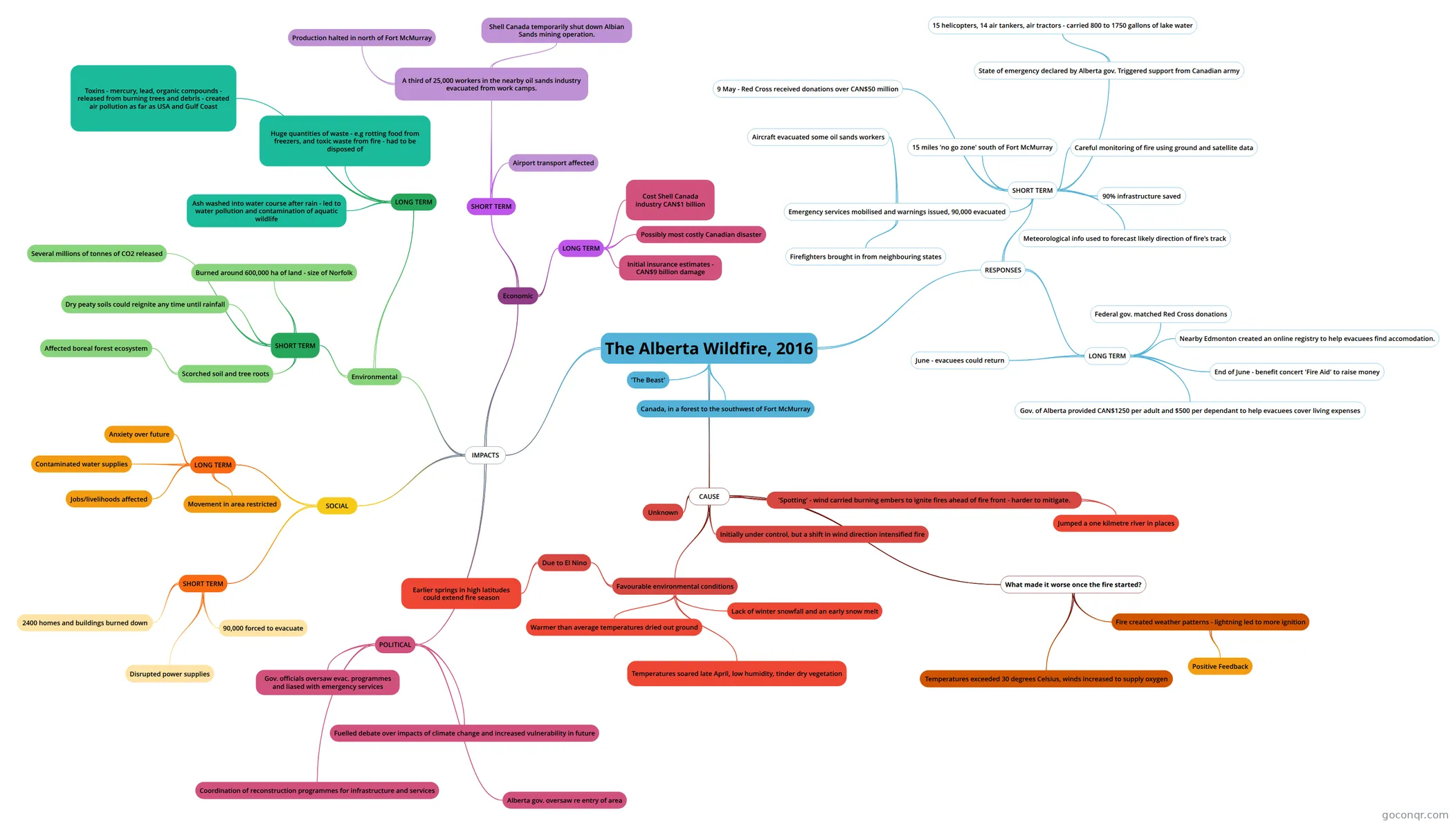
Mind map: The Alberta Wildfire, 2016
Map content
The Alberta Wildfire, 2016
'The Beast'
Canada, in a forest to the southwest of Fort McMurray
CAUSE
- Unknown
- Initially under control, but a shift in wind direction intensified fire
- 'Spotting' - wind carried burning embers to ignite fires ahead of fire front - harder to mitigate.
- Jumped a one kilmetre river in places
- Favourable environmental conditions
- Lack of winter snowfall and an early snow melt
- Warmer than average temperatures dried out ground
- Temperatures soared late April, low humidity, tinder dry vegetation
- Due to El Nino
- Earlier springs in high latitudes could extend fire season
- What made it worse once the fire started?
- Temperatures exceeded 30 degrees Celsius, winds increased to supply oxygen
- Fire created weather patterns - lightning led to more ignition
- Positive Feedback
IMPACTS
- SOCIAL
- SHORT TERM
- 90,000 forced to evacuate
- 2400 homes and buildings burned down
- Disrupted power supplies
- LONG TERM
- Movement in area restricted
- Jobs/livelihoods affected
- Anxiety over future
- Contaminated water supplies
- SHORT TERM
- Environmental
- SHORT TERM
- Scorched soil and tree roots
- Affected boreal forest ecosystem
- Dry peaty soils could reignite any time until rainfall
- Burned around 600,000 ha of land - size of Norfolk
- Several millions of tonnes of CO2 released
- Scorched soil and tree roots
- LONG TERM
- Huge quantities of waste - e.g rotting food from freezers, and toxic waste from fire - had to be disposed of
- Ash washed into water course after rain - led to water pollution and contamination of aquatic wildlife
- Toxins - mercury, lead, organic compounds - released from burning trees and debris - created air pollution as far as USA and Gulf Coast
- SHORT TERM
- Economic
- SHORT TERM
- A third of 25,000 workers in the nearby oil sands industry evacuated from work camps.
- Production halted in north of Fort McMurray
- Shell Canada temporarily shut down Albian Sands mining operation.
- Airport transport affected
- A third of 25,000 workers in the nearby oil sands industry evacuated from work camps.
- LONG TERM
- Cost Shell Canada industry CAN$1 billion
- Initial insurance estimates - CAN$9 billion damage
- Possibly most costly Canadian disaster
- SHORT TERM
- POLITICAL
- Fuelled debate over impacts of climate change and increased vulnerability in future
- Gov. officials oversaw evac. programmes and liased with emergency services
- Coordination of reconstruction programmes for infrastructure and services
- Alberta gov. oversaw re entry of area
- SOCIAL
RESPONSES
- SHORT TERM
- 15 miles 'no go zone' south of Fort McMurray
- Careful monitoring of fire using ground and satellite data
- Meteorological info used to forecast likely direction of fire's track
- Emergency services mobilised and warnings issued, 90,000 evacuated
- Aircraft evacuated some oil sands workers
- Firefighters brought in from neighbouring states
- 90% infrastructure saved
- State of emergency declared by Alberta gov. Triggered support from Canadian army
- 15 helicopters, 14 air tankers, air tractors - carried 800 to 1750 gallons of lake water
- 9 May - Red Cross received donations over CAN$50 million
- LONG TERM
- Federal gov. matched Red Cross donations
- Gov. of Alberta provided CAN$1250 per adult and $500 per dependant to help evacuees cover living expenses
- Nearby Edmonton created an online registry to help evacuees find accomodation.
- June - evacuees could return
- End of June - benefit concert 'Fire Aid' to raise money
- SHORT TERM
Information
- GoConqr Review
- Great MindMap detailing the Alberta Wildfire of 2016
- Description
- AS level Geography Mind Map on The Alberta Wildfire, 2016, created by Lauren Bradford on 06/03/2017.
- Created by
- Lauren Bradford
- Views
- 2,103
- Tags
- Rating