
Mind map
Water on the Land
Map content
Water on the Land
How do river valleys change downstream?
- Processes of erosion
- Hydraulic Action
- Abrasion
- Attrition
- Solution
- Processes of Transportation
- Traction
- Saltation
- Suspension
- Solution
- Deposition
- Profiles
- Long profile
- Changes downstream
- Cross profile
- Changes across the channel
- Long profile
- Processes of erosion
Distinctive landforms
- Resulting from erosion
- Waterfalls and gorges
- River Tees
- Upper Course
- Middle Course
- Lower Course
- River Tees
- Waterfalls and gorges
- Resulting from erosion and deposition
- Meanders and ox-bow lakes
- Resulting from deposition
- Levees and floodplains
- Resulting from erosion
Fluctuating water levels in rivers
- Movement of water in drainage basins
- Channel flow
- Groundwater flow
- Throughflow
- Percolation
- Groundwater
- Soil moisture
- Infiltration
- Surface storage
- Surface runoff
- Interception
- Transpiration
- Evaporation
- Precipitation
- Factors affecting river discharge
- Amount and type of rainfall
- Temperature
- Previous weather conditions
- Rock type
- Land use
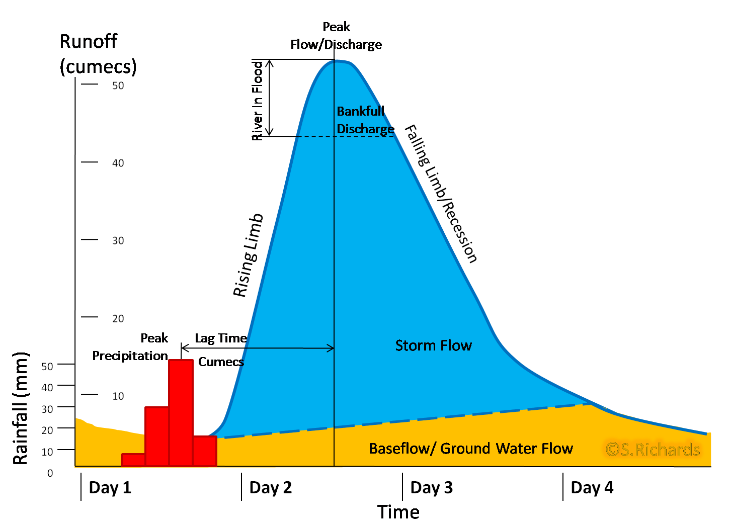
- Storm Hydrographs
- Movement of water in drainage basins
Why do rivers flood?
- Causes
- Prolonged rainfall
- Heavy rain
- Snowmelt
- Steep relief
- Soil erosion
- Frequency
- Increasing frequency in UK
- East Coast 1953
- Northampton 1998
- River Severn 2007
- South West England 2014
- Increasing frequency in UK
- Causes
Why do responses to flooding vary?
- Rich World Cockermouth Cumbria November 2009
- Causes, effects, responses
- Poor World Bangladesh 2004
- Causes, effects, responses
- Rich World Cockermouth Cumbria November 2009
Hard and soft engineering responses to flooding
- Hard engineering
- Dams
- 3 Gorges Dam, China
- Reservoirs
- Straightening meanders
- Dams
- Soft engineering
- Flood warning system
- Northampton St. James
- Floodplain zoning
- Flood warning system
- Hard engineering
How are rivers in the UK managed to provide water supply?
- Water consumption
- Greater in south-east
- Rainfall
- Less in south-east
- Water stress
- Water Transfer
- Kielder water
- Water consumption
Images and files in the map
Information
- Description
- Year 11 Geography (Water on the Land) Mind Map on Water on the Land, created by Daniel Flint on 03/04/2017.
- Created by
- Daniel Flint
- Views
- 1
- Tags
- History
-
- Created by John Ditchburn · Mar 20, 2014
- Copied by Daniel Flint · Apr 3, 2017
- Rating