
Mindmap
Physical
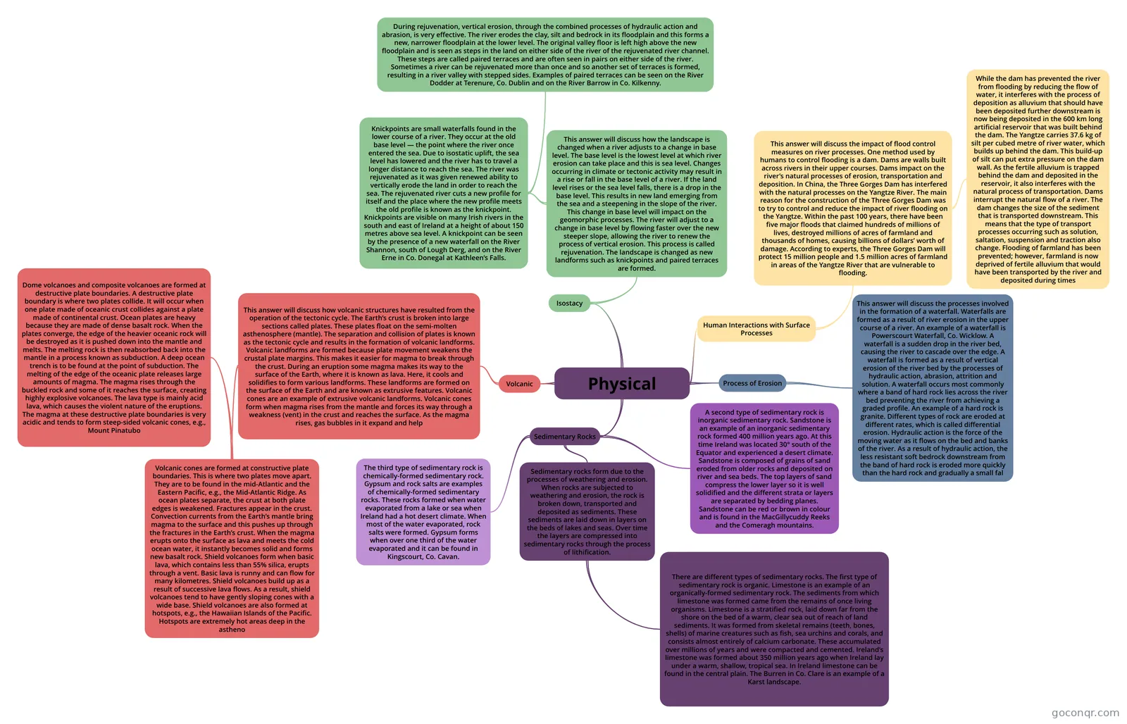
Mind map: Physical geography mind map
Inhalt der Mindmap
Physical
Sedimentary Rocks
- Sedimentary rocks form due to the processes of weathering and erosion. When rocks are subjected to weathering and erosion, the rock is broken down, transported and deposited as sediments. These sediments are laid down in layers on the beds of lakes and seas. Over time the layers are compressed into sedimentary rocks through the process of lithification.
- There are different types of sedimentary rocks. The first type of sedimentary rock is organic. Limestone is an example of an organically-formed sedimentary rock. The sediments from which limestone was formed came from the remains of once living organisms. Limestone is a stratified rock, laid down far from the shore on the bed of a warm, clear sea out of reach of land sediments. It was formed from skeletal remains (teeth, bones, shells) of marine creatures such as fish, sea urchins and corals, and consists almost entirely of calcium carbonate. These accumulated over millions of years and were compacted and cemented. Ireland’s limestone was formed about 350 million years ago when Ireland lay under a warm, shallow, tropical sea. In Ireland limestone can be found in the central plain. The Burren in Co. Clare is an example of a Karst landscape.
- A second type of sedimentary rock is inorganic sedimentary rock. Sandstone is an example of an inorganic sedimentary rock formed 400 million years ago. At this time Ireland was located 30° south of the Equator and experienced a desert climate. Sandstone is composed of grains of sand eroded from older rocks and deposited on river and sea beds. The top layers of sand compress the lower layer so it is well solidified and the different strata or layers are separated by bedding planes. Sandstone can be red or brown in colour and is found in the MacGillycuddy Reeks and the Comeragh mountains.
- The third type of sedimentary rock is chemically-formed sedimentary rock. Gypsum and rock salts are examples of chemically-formed sedimentary rocks. These rocks formed when water evaporated from a lake or sea when Ireland had a hot desert climate. When most of the water evaporated, rock salts were formed. Gypsum forms when over one third of the water evaporated and it can be found in Kingscourt, Co. Cavan.
- Sedimentary rocks form due to the processes of weathering and erosion. When rocks are subjected to weathering and erosion, the rock is broken down, transported and deposited as sediments. These sediments are laid down in layers on the beds of lakes and seas. Over time the layers are compressed into sedimentary rocks through the process of lithification.
Process of Erosion
- This answer will discuss the processes involved in the formation of a waterfall. Waterfalls are formed as a result of river erosion in the upper course of a river. An example of a waterfall is Powerscourt Waterfall, Co. Wicklow. A waterfall is a sudden drop in the river bed, causing the river to cascade over the edge. A waterfall is formed as a result of vertical erosion of the river bed by the processes of hydraulic action, abrasion, attrition and solution. A waterfall occurs most commonly where a band of hard rock lies across the river bed preventing the river from achieving a graded profile. An example of a hard rock is granite. Different types of rock are eroded at different rates, which is called differential erosion. Hydraulic action is the force of the moving water as it flows on the bed and banks of the river. As a result of hydraulic action, the less resistant soft bedrock downstream from the band of hard rock is eroded more quickly than the hard rock and gradually a small fal
Human Interactions with Surface Processes
- This answer will discuss the impact of flood control measures on river processes. One method used by humans to control flooding is a dam. Dams are walls built across rivers in their upper courses. Dams impact on the river’s natural processes of erosion, transportation and deposition. In China, the Three Gorges Dam has interfered with the natural processes on the Yangtze River. The main reason for the construction of the Three Gorges Dam was to try to control and reduce the impact of river flooding on the Yangtze. Within the past 100 years, there have been five major floods that claimed hundreds of millions of lives, destroyed millions of acres of farmland and thousands of homes, causing billions of dollars’ worth of damage. According to experts, the Three Gorges Dam will protect 15 million people and 1.5 million acres of farmland in areas of the Yangtze River that are vulnerable to flooding.
- While the dam has prevented the river from flooding by reducing the flow of water, it interferes with the process of deposition as alluvium that should have been deposited further downstream is now being deposited in the 600 km long artificial reservoir that was built behind the dam. The Yangtze carries 37.6 kg of silt per cubed metre of river water, which builds up behind the dam. This build-up of silt can put extra pressure on the dam wall. As the fertile alluvium is trapped behind the dam and deposited in the reservoir, it also interferes with the natural process of transportation. Dams interrupt the natural flow of a river. The dam changes the size of the sediment that is transported downstream. This means that the type of transport processes occurring such as solution, saltation, suspension and traction also change. Flooding of farmland has been prevented; however, farmland is now deprived of fertile alluvium that would have been transported by the river and deposited during times
- This answer will discuss the impact of flood control measures on river processes. One method used by humans to control flooding is a dam. Dams are walls built across rivers in their upper courses. Dams impact on the river’s natural processes of erosion, transportation and deposition. In China, the Three Gorges Dam has interfered with the natural processes on the Yangtze River. The main reason for the construction of the Three Gorges Dam was to try to control and reduce the impact of river flooding on the Yangtze. Within the past 100 years, there have been five major floods that claimed hundreds of millions of lives, destroyed millions of acres of farmland and thousands of homes, causing billions of dollars’ worth of damage. According to experts, the Three Gorges Dam will protect 15 million people and 1.5 million acres of farmland in areas of the Yangtze River that are vulnerable to flooding.
Volcanic
- This answer will discuss how volcanic structures have resulted from the operation of the tectonic cycle. The Earth’s crust is broken into large sections called plates. These plates float on the semi-molten asthenosphere (mantle). The separation and collision of plates is known as the tectonic cycle and results in the formation of volcanic landforms. Volcanic landforms are formed because plate movement weakens the crustal plate margins. This makes it easier for magma to break through the crust. During an eruption some magma makes its way to the surface of the Earth, where it is known as lava. Here, it cools and solidifies to form various landforms. These landforms are formed on the surface of the Earth and are known as extrusive features. Volcanic cones are an example of extrusive volcanic landforms. Volcanic cones form when magma rises from the mantle and forces its way through a weakness (vent) in the crust and reaches the surface. As the magma rises, gas bubbles in it expand and help
- Volcanic cones are formed at constructive plate boundaries. This is where two plates move apart. They are to be found in the mid-Atlantic and the Eastern Pacific, e.g., the Mid-Atlantic Ridge. As ocean plates separate, the crust at both plate edges is weakened. Fractures appear in the crust. Convection currents from the Earth’s mantle bring magma to the surface and this pushes up through the fractures in the Earth’s crust. When the magma erupts onto the surface as lava and meets the cold ocean water, it instantly becomes solid and forms new basalt rock. Shield volcanoes form when basic lava, which contains less than 55% silica, erupts through a vent. Basic lava is runny and can flow for many kilometres. Shield volcanoes build up as a result of successive lava flows. As a result, shield volcanoes tend to have gently sloping cones with a wide base. Shield volcanoes are also formed at hotspots, e.g., the Hawaiian Islands of the Pacific. Hotspots are extremely hot areas deep in the astheno
- Dome volcanoes and composite volcanoes are formed at destructive plate boundaries. A destructive plate boundary is where two plates collide. It will occur when one plate made of oceanic crust collides against a plate made of continental crust. Ocean plates are heavy because they are made of dense basalt rock. When the plates converge, the edge of the heavier oceanic rock will be destroyed as it is pushed down into the mantle and melts. The melting rock is then reabsorbed back into the mantle in a process known as subduction. A deep ocean trench is to be found at the point of subduction. The melting of the edge of the oceanic plate releases large amounts of magma. The magma rises through the buckled rock and some of it reaches the surface, creating highly explosive volcanoes. The lava type is mainly acid lava, which causes the violent nature of the eruptions. The magma at these destructive plate boundaries is very acidic and tends to form steep-sided volcanic cones, e.g., Mount Pinatubo
- Volcanic cones are formed at constructive plate boundaries. This is where two plates move apart. They are to be found in the mid-Atlantic and the Eastern Pacific, e.g., the Mid-Atlantic Ridge. As ocean plates separate, the crust at both plate edges is weakened. Fractures appear in the crust. Convection currents from the Earth’s mantle bring magma to the surface and this pushes up through the fractures in the Earth’s crust. When the magma erupts onto the surface as lava and meets the cold ocean water, it instantly becomes solid and forms new basalt rock. Shield volcanoes form when basic lava, which contains less than 55% silica, erupts through a vent. Basic lava is runny and can flow for many kilometres. Shield volcanoes build up as a result of successive lava flows. As a result, shield volcanoes tend to have gently sloping cones with a wide base. Shield volcanoes are also formed at hotspots, e.g., the Hawaiian Islands of the Pacific. Hotspots are extremely hot areas deep in the astheno
- This answer will discuss how volcanic structures have resulted from the operation of the tectonic cycle. The Earth’s crust is broken into large sections called plates. These plates float on the semi-molten asthenosphere (mantle). The separation and collision of plates is known as the tectonic cycle and results in the formation of volcanic landforms. Volcanic landforms are formed because plate movement weakens the crustal plate margins. This makes it easier for magma to break through the crust. During an eruption some magma makes its way to the surface of the Earth, where it is known as lava. Here, it cools and solidifies to form various landforms. These landforms are formed on the surface of the Earth and are known as extrusive features. Volcanic cones are an example of extrusive volcanic landforms. Volcanic cones form when magma rises from the mantle and forces its way through a weakness (vent) in the crust and reaches the surface. As the magma rises, gas bubbles in it expand and help
Isostacy
- This answer will discuss how the landscape is changed when a river adjusts to a change in base level. The base level is the lowest level at which river erosion can take place and this is sea level. Changes occurring in climate or tectonic activity may result in a rise or fall in the base level of a river. If the land level rises or the sea level falls, there is a drop in the base level. This results in new land emerging from the sea and a steepening in the slope of the river. This change in base level will impact on the geomorphic processes. The river will adjust to a change in base level by flowing faster over the new steeper slope, allowing the river to renew the process of vertical erosion. This process is called rejuvenation. The landscape is changed as new landforms such as knickpoints and paired terraces are formed.
- Knickpoints are small waterfalls found in the lower course of a river. They occur at the old base level — the point where the river once entered the sea. Due to isostatic uplift, the sea level has lowered and the river has to travel a longer distance to reach the sea. The river was rejuvenated as it was given renewed ability to vertically erode the land in order to reach the sea. The rejuvenated river cuts a new profile for itself and the place where the new profile meets the old profile is known as the knickpoint. Knickpoints are visible on many Irish rivers in the south and east of Ireland at a height of about 150 metres above sea level. A knickpoint can be seen by the presence of a new waterfall on the River Shannon, south of Lough Derg, and on the River Erne in Co. Donegal at Kathleen’s Falls.
- During rejuvenation, vertical erosion, through the combined processes of hydraulic action and abrasion, is very effective. The river erodes the clay, silt and bedrock in its floodplain and this forms a new, narrower floodplain at the lower level. The original valley floor is left high above the new floodplain and is seen as steps in the land on either side of the river of the rejuvenated river channel. These steps are called paired terraces and are often seen in pairs on either side of the river. Sometimes a river can be rejuvenated more than once and so another set of terraces is formed, resulting in a river valley with stepped sides. Examples of paired terraces can be seen on the River Dodder at Terenure, Co. Dublin and on the River Barrow in Co. Kilkenny.
- Knickpoints are small waterfalls found in the lower course of a river. They occur at the old base level — the point where the river once entered the sea. Due to isostatic uplift, the sea level has lowered and the river has to travel a longer distance to reach the sea. The river was rejuvenated as it was given renewed ability to vertically erode the land in order to reach the sea. The rejuvenated river cuts a new profile for itself and the place where the new profile meets the old profile is known as the knickpoint. Knickpoints are visible on many Irish rivers in the south and east of Ireland at a height of about 150 metres above sea level. A knickpoint can be seen by the presence of a new waterfall on the River Shannon, south of Lough Derg, and on the River Erne in Co. Donegal at Kathleen’s Falls.
- This answer will discuss how the landscape is changed when a river adjusts to a change in base level. The base level is the lowest level at which river erosion can take place and this is sea level. Changes occurring in climate or tectonic activity may result in a rise or fall in the base level of a river. If the land level rises or the sea level falls, there is a drop in the base level. This results in new land emerging from the sea and a steepening in the slope of the river. This change in base level will impact on the geomorphic processes. The river will adjust to a change in base level by flowing faster over the new steeper slope, allowing the river to renew the process of vertical erosion. This process is called rejuvenation. The landscape is changed as new landforms such as knickpoints and paired terraces are formed.
Informationen
- Beschreibung
- Mindmap am Physical, erstellt von Amanda Andrite am 06/06/2024.
- Erstellt von
- Amanda Andrite
- Aufrufe
- 1
- Bewertung